Regular public transport commuters are likely to have their train routes memorised by heart. But those who are unfamiliar with the stations, or the different LRT lines will surely scramble for a map to ensure that they are heading the right way. This was what inspired local web developer Emil Shafy to create an innovative Augmented Reality (AR) app to help commuters to easily navigate all available train routes.
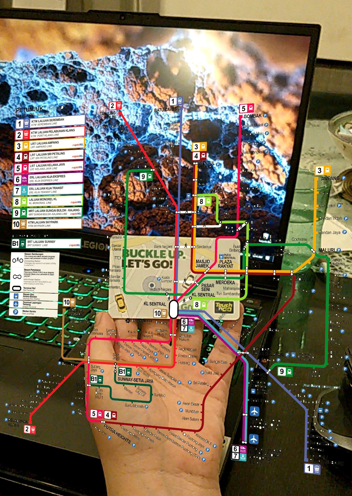
How the app works is actually pretty simple. As demonstrated by Emil in a short video uploaded to his Twitter account, all that is required is to aim your phone camera to your Touch ‘n Go (TnG) card and a floating map of the LRT routes will appear. Navigating the map is done by either moving the card or the phone’s camera around.
Made an LRT map appear on my Touch N Go card in AR. Woohoo! still a bit buggy but helpful if we’re ever lost pic.twitter.com/ynZKEaA4WQ
— emil (@emlshfy) August 17, 2020
When asked about what inspired him to go with an AR approach for the app, Emil told us that the idea sparked when he viewed a TikTok video demonstrating an Augmented Reality-based business card. With prior experience in 3D programming and some new skills that he picked up during the Movement Control Order (MCO), the 24-year-old web developer completed a working proof-of-concept based on this new idea in not more than 2 days.
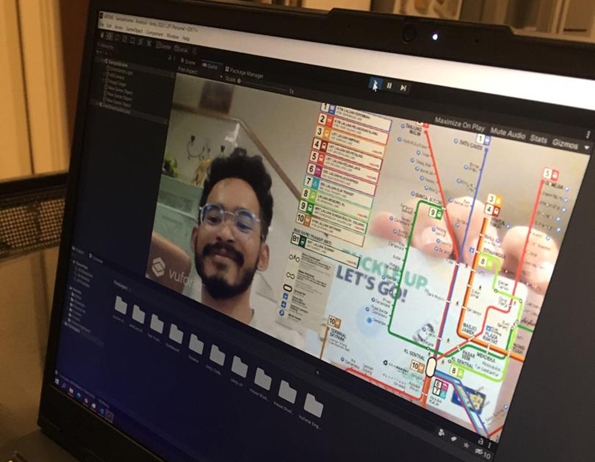
Emil explained that he dabbled with EasyAR and ARFoundation during the app’s development, and later settled with Unity and Vuforia. He added that he plans to add more features based on new ideas, as well as user feedback from Twitter. The AR app is currently developed for Android and iOS, and he is also considering having a web version available in the near future.
Much to Emil’s surprise, the video demonstration of the app on Twitter was very well received from a lot of fellow Malaysians. Some even encouraged public transport operator Prasarana to take notice of this concept and consider working with the developer to make this into a full-fledged application.
“I have been contacted by their social media team, and would love to see where it would take me,” he said in his reply to our email. “I am excited to be collaborating and working on this project with them.”
Emil added that he would be more than glad to take on more projects that would help ease our daily commute, should the opportunity arise. It’s also worth noting that the young developer was previously part of a small video game production team who took part in the Malaysian indie developer showcase at Tokyo Game Show in 2018.
“My advice would be to keep on persevering and staying positive,” he told us when asked if there was anything he would like to share with other aspiring creators. “Clarity will come from experience and practice, and mistakes exist so that we can learn from them.”
The post Local Web Developer Creates Convenient AR Map For LRT Routes appeared first on Lowyat.NET.
This content was originally published here.